Introduction
Outline
In preparation for the class we ask that everyone familiarize themself with the syllabus, course outline & assignments. Once students feel familiarized with the course material and themes, we propose as a pre-exercise that each student starts to speculate on their own initial definitions of the course subject matter, and areas of interest.
Assigmnent 0
Bring to class your own definition of mobility and an example of a conflict. These definitions will help us collectively discuss what each terminology means within the context of the course, and further what initial case studies emerge from our individual and collective interests.
It is important to fill these out via the Google Sheet before class, as we look to cover a diverse range of case studies and want to avoid repetition.
Required readings
- (Interview) Eyal Weizman: Forensic Architecture is Looking at the Past to Transform the Future Video Interview
- (Book) Laura Kurgan: Close Up at a Distance, Mapping, Technology, and Politics (p 9–36)
Phase I - Visual
Outline
Visual relationships can be defined as the associations between a set of visual artifacts. These relationships may pertain to anything, including what is presented in an image, object or film, its stylistic qualities, media, source, or means of representation. Visual relationships are often crucial in the investigative practices and forensic analysis, as visual evidence is assembled and mobilized to argue cases, concepts and philosophies across numerous forums. In our initial encounter with our chosen case studies, visual analysis will enable us to make sense of the evidentiary materials available, and the actors and relationships at play across various modes of conflict and mobility.
Students will be encouraged to pair wider non-visual research practices alongside image, object or film driven analysis, delving into archives, social media and satellite feeds in order to assemble a visual archive for a chosen case study which will assist in informing our research directions throughout Phase II.
Assignment 01
Students will be asked to present 30 images of their choosing via a pre-prepared Miro board format. Each group of 2 will be asked to present for 5 minutes, introduce their investigations and explain the relationships between their chosen set of images. We ask in conclusion that students highlight potential ways in which we might explore data driven approaches to their chosen investigation, informed by the phenomena and relationships outlined during their visual research.
Required Readings
- (Film) Adam Curtis: The Use and Abuse of Vegetational Concepts
- (Film) John Berger: Ways of Seeing, Episode 1 (1972)
Visual References

Unknown - The Paston of Treasures
The Paston Treasure is an oil painting that serves as a historically rare record of a cabinet of treasures in British collecting. Commissioned by either Sir Robert Paston or his father Sir William Paston in the early 1660s, it depicts a small fraction of the Paston family's collected treasures. The importance of The Paston Treasure lies in the international scope and interest of the objects portrayed.
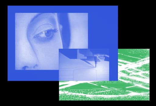
Harun Farocki - Reality Would Have to Begin
As a director, screenwriter, artist and author, Harun Farocki created an impressive body of work, including over 100 films, which defy categorization in a single genre. He is known for his unique voice and experimental approach to the image and montage—constantly bringing the dialogue between image and image into a close-up—as well as for the way he formulates a critical discourse on history and social realities which he analyzes meticulously by linking the political to the visual.
https://www.e-flux.com/announcements/342519/harun-farockireality-would-have-to-begin/
Phase II - Geospatial
Outline
Both modes of conflict and mobility unfold across a series of spatial dimensions. Throughout the geospatial phase of analysis we will investigate the architectures both influencing and being influenced by forms of conflict and mobility, operating between the scales of the territory and the body. We will explore map-making as both a critical process and forensic device to uncover the spatial extents of conflicts, helping students to understand the architectural processes relevant to the expanded field of their investigation. Across groups of 2, students will engage in a range of investigative and analytical map making practices across platforms such as QGIS and Earth Engine. Each group will develop bespoke methodologies in both map making and visualization which deal with data-driven approaches for the investigation of their chosen case study.
Assignment 02
Students will be asked to present the results of their studies into the geospatial dimensions of their investigation through individual, or series of cartographic artifacts. Cartographic artifacts may be defined in broad terms, including videos, digital platforms, sketches and static maps, yet each should be informed by critical forensic practices and research-driven approaches to mapping. Each map must critically engage with the politics of representation and reflect a conscious consideration of the data both included and omitted in its preparation. Each map must competently demarcate the spatial parameters of the relevant investigation, whilst engaging with experimental and/or referential forms of visualization relevant to their chosen investigation.
Presentation of Assignment 02 will be conducted in pairs in no longer than 10 minutes. Students will be asked to introduce their case, narrate and outline its spatial parameters through the context of their map whilst highlighting the technical and forensic methodologies utilized throughout the process.
Required Readings
- (Film) Moritz Siebert, Abou Bakar Sidibé, Estephan Wagner: Those Who Jump
- (Essay) James Corner: The Agency of Mapping
Visual References
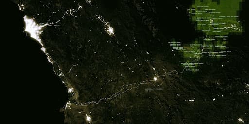
Warning Office - In Plain Sight
In Plain Site argues that a conventional reading or use of common global data sets often obscures numerous forms of being in the world while making other forms of citizenship highly legible. This piece attempts to highlight this in an affirmative fashion: by reading these datasets differently they can be used to highlight more obscure forms of citizenship and open them up to narrative speculation.
https://www.warning-office.org/wo-in-plain-site
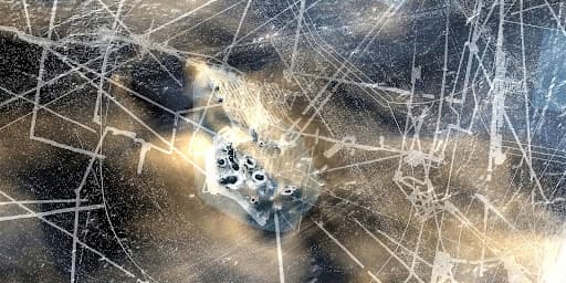
Territorial Agency - Oceans in Transformation
The research project assembles a variety of scientific datasets stemming from multiple research institutions to depict the magnitude of human impact on marine life. What emerges is a series of dynamic compositions that are disquieting and disorienting: the image of an empty ocean lingers on in many of us.
https://www.territorialagency.com/oceans
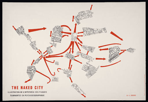
Guy Debord - The Naked City
Deliberately fragmented, Debord’s composition of 19 sections of a map of Paris demonstrates a “subjective and temporal experience of the city as opposed to the seemingly omnipotent perspective of the planimetric map” (Alison Sant).
Phase III - Temporal
Outline
Temporal describes the relationship of events, objects and spaces over time. In the context of investigative practices, timelines are crucial tools for establishing the unfolding of events in order to understand forms of accountability. In turn, allowing us to understand not only how an event took place but why.
Whilst previous work in both the visual and geospatial phases may have already touched upon temporal dimensions of spatial transformations, in this phase we will further embellish and investigate the temporal chain of events surrounding our chosen case studies. Timelines and chronological reconstructions will operate between both human-centric and geological time scales. With the exercise assisting us in defining the temporal limits of our chosen case study, whilst helping us to further interrogate the often peripheral phenomena which influence and express themselves in the velocity of contemporary conflicts.
Assignment 03
Students will be asked to present the results of their studies into the temporal dimensions of their investigation through an interpretation of a timeline. This may be a static drawing, animation, platform, image series or any other format students believe critically demonstrates an engagement with the temporal dimensions of their investigation. The production of the timeline will involve non-visual research into the social, financial, environmental and geopolitical contexts of their investigation, with the aim of articulating a highly developed understanding of the historical, current and future forces at play within their case study. Timescales of analysis will differ between groups however each must equally show a breadth of research and a highly considered approach to the graphic visualization. Through identifying the wider geopolitical forces at play within each case students will prepare themselves well for the following phase of the investigation.
Required Readings
- (Video) Forensic Architecture: Environmental Racism in Death Alley, Louisiana - link
- (Book) Rob Nixon: Slow Violence, Introduction
Visual References
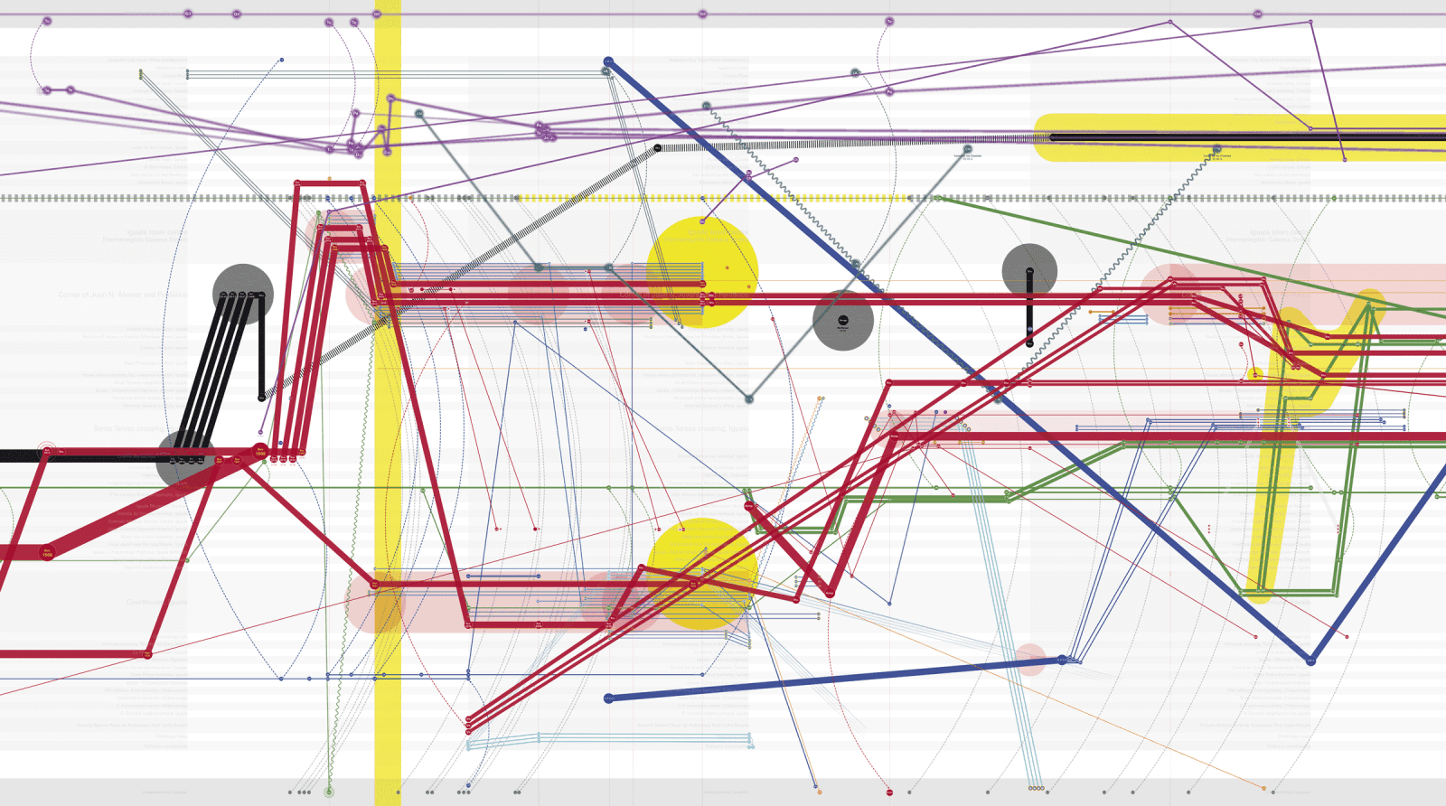
Forensic Architecture - The Enforced Disappearances of the Ayotzinapa Students
IThe Ayotzinapa mural is composed of the data drawn by researchers from the pages of relevant incident reports, and the research of journalist John Gibler outlining the forced disappearance of a group of school children in Mexico. Drawing from the tradition of Mexican muralism, which have long addressed political and social themes, the mural charts the night of 26–27 September 2014 across the time and space through which those events unfolded. By graphically representing the testimonies of survivors, suspects and state representatives, and the narratives of the subsequent investigations into the case, the divergences between these many accounts of the night become evident.
https://forensic-architecture.org/investigation/the-enforced-disappearance-of-the-ayotzinapa-students
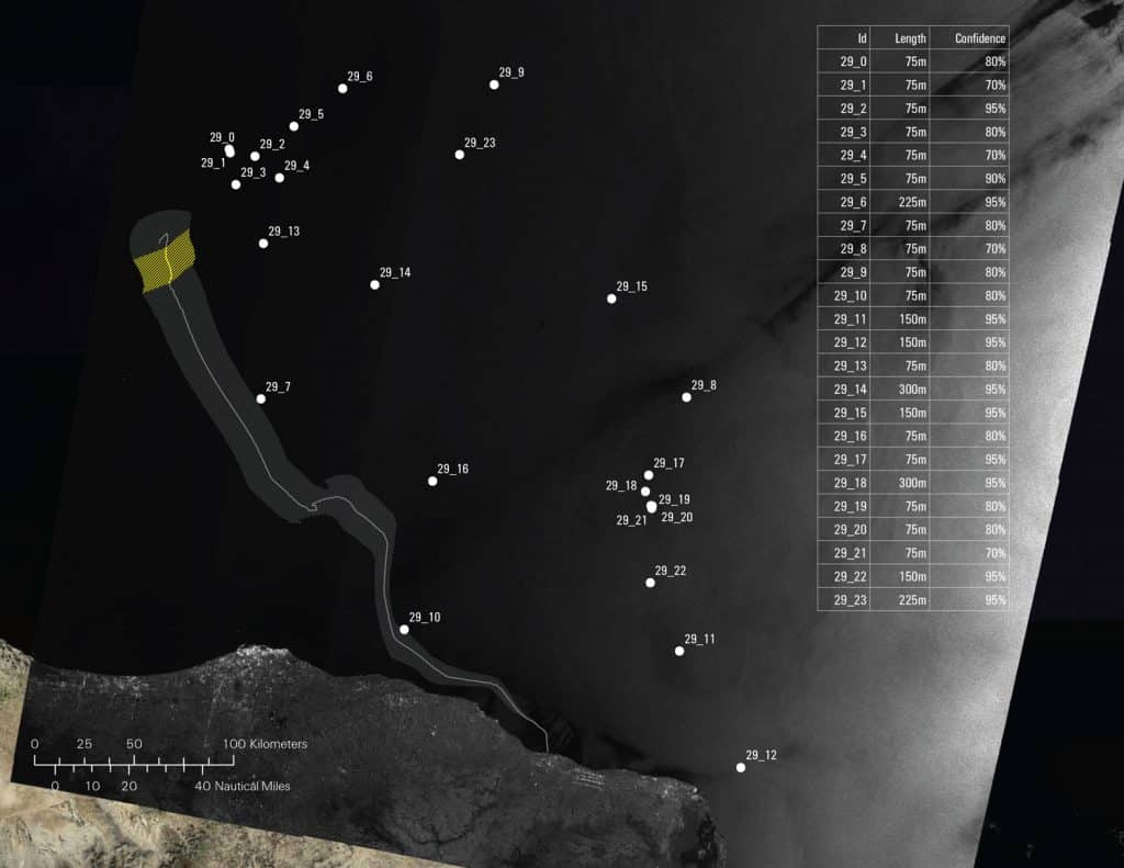
Forensic Oceanography - Left to Die Boat
In March 2011, 72 passengers left the Libyan coast heading in the direction of Italy on board a small rubber boat at the time of NATO’s military intervention in Libya. Despite several distress signals relaying their location, as well as repeated interactions with at least one military helicopter and a military ship, they were left to drift for 14 days. As a result of the inaction of all state actors involved, only nine of the passengers survived. By combining their testimonies with wind and sea-current data as well as satellite imagery, Forensic Oceanography reconstructed the liquid traces of this event, producing a report that served as the basis of several legal complaints.
https://forensic-architecture.org/investigation/the-left-to-die-boat
Phase IV - Relational
Outline
Relations are apparent in the connection of all things. In Phase IV we seek to expand upon the geospatial and temporal relations that the previous phases addressed. We will elucidate connections that will enable us to detect and argue for the presence of systemic conditions driving shifts in both conflict and mobility. During this phase we will both synergize the previous work carried out across each investigation and challenge ourselves to identify systemic issues and strategies for intervention. We will test practices to define both statistical relationships and systemic cultural conditions, and encourage students to expand upon their research and test their findings against generalized data sets / phenomena.
Crucial to this practice will be both the visualization and the communication of the investigations material, developing dynamic and interactive ways of communicating data and research in order to narrate the critical elements of each investigation. At this moment students will be encouraged to think about the potential outcomes of their research and develop audience-oriented visualizations with clear political and design-based agendas.
Assignment 04
Assignment 04 will lead directly into the final presentation; formats for the presentation of this work will differ greatly between each project, based on students’ interests and technical skill sets. Despite that, each project must demonstrate a clear engagement with network-thinking and position the research in the context of a network, outlining the full scope of the chosen conflict, and its effect(s) on mobility. Formats for the final presentations will be workshopped in collaboration with each group and may include videos, static drawings, interactive platforms, Mapbox stories etc. A decision will be made collectively in week 8 regarding formats for the final project and aims for the final presentation.
Required Readings
- (Film) Adam Curtis: HyperNormalisation
Visual References
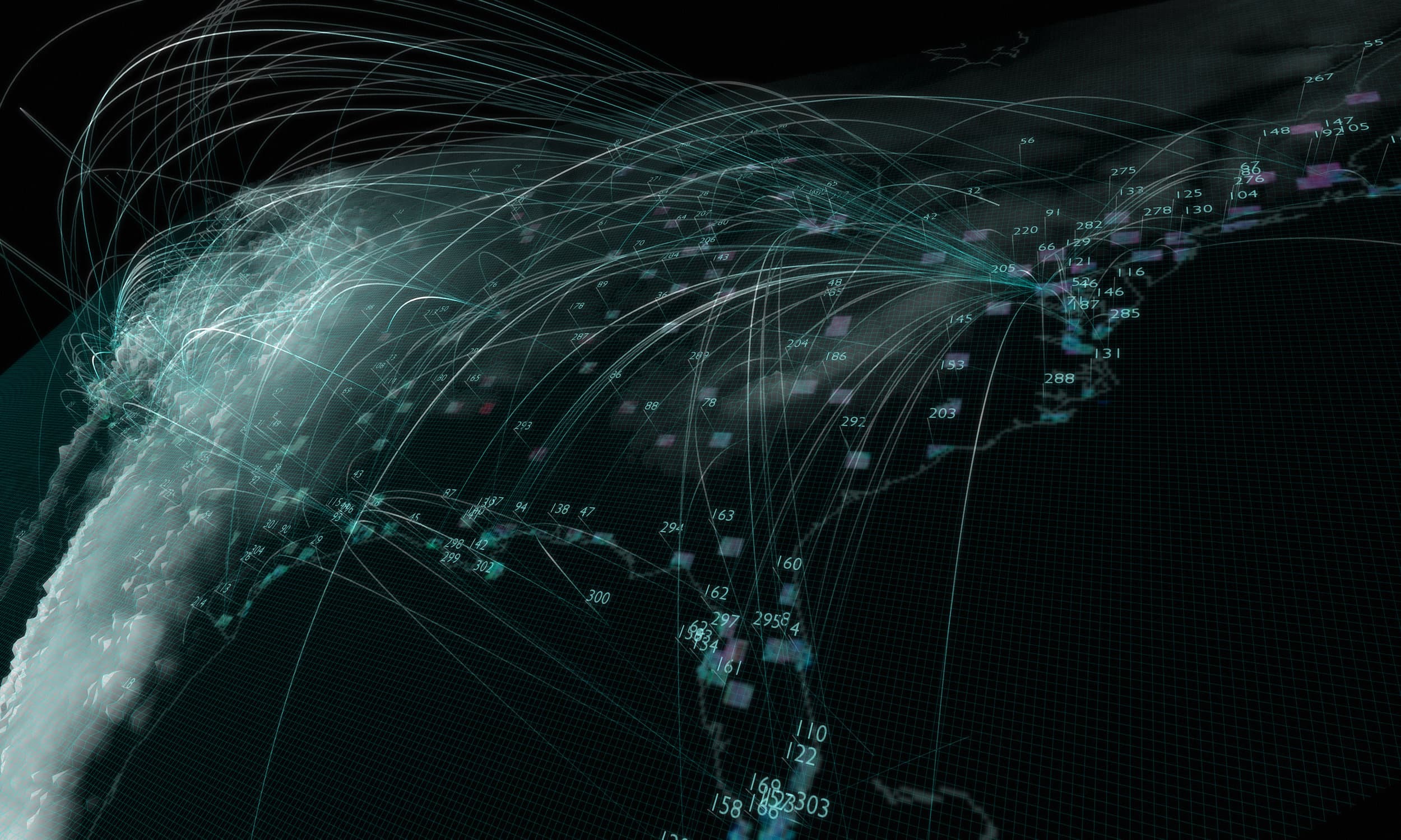
Warning Office - Test Sites
Test Sites is an on-going research project that explores the history of environmental Remote Sensing through data mining, mapping, and visualization. The project specifically attempts to ground this history in very real landscapes and territories by focusing on over the 300 geographic “Test Sites” that were used by federal and academic researchers during the creation of this field. It is at these locations that sensing technology found its practical applications, and where the first translation from environment to data occurred.
https://www.warning-office.org/wo-test-sites
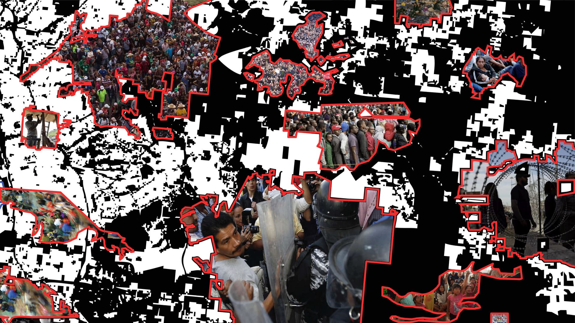
Teddy Cruz - The Political Equator
The Political Equator is an iterative research and visualization project that links the most contested geographies and border conditions across the globe between the 30-38 degree north parallel. Learning from the networked dynamics of these spaces, the exchanges and flows of material, people and knowledge the project seeks to foster exchanges between zones of contestation, sharing strategies for resistance both civic, economic, and environmental.
https://www.e-flux.com/architecture/at-the-border/358908/unwalling-citizenship/
Phase V - Presentation
Outline
Students will be invited to present their work in groups of 4, outlining the work undertaken during the course. Each presentation must demonstrate how the methodologies and practices developed throughout the course constitute modes of resistance and/or practices for engaging with the design of mobility. Formats for each presentation will be largely driven by discussions developed during Phase IV; however, they need to clearly articulate the key audiences and relevant stakeholders of the project, situating the research beyond an academic context and as an agent of active political change. Presentations will be 15 minutes long, leaving 25 minutes for comments and discussion.
Phase X - The Digital Garden
Outline
During the course the class will collectively produce an invaluable and crucial archive surrounding the confluence of conflict and mobility. In order to foster an open-source and public-facing approach to this media, students will be asked to collate, prepare and submit their work to the Networked Flows digital garden; a custom-built platform that will showcase the collective work of the class and serve as a future resource for both ourselves and others.
Assignment
Digital programming of the platform and its preparation will be handled by the instructors, with the primary submission of work the digital occurring in week 09. Further instructions as to required formats for preparation will be provided during the duration of the course and reflect the dynamic and varied material produced by the class. The class digital garden will be discussed collectively during Phase IV and launched alongside the final presentations in week 11.
IAAC Blog
Students are also requested to submit all the material on the IAAC Gdrive and a Blog post need to be curated on iaacblog.net for each project (see “IAAC | Publication Guidelines”) within a maximum of 1 week after the end of the Seminar.